2GIS is your ultimate companion for navigating both familiar and new territories. With its comprehensive features, including offline maps, GPS navigation, real-time traffic updates, parking information, and transit routes, you'll never feel lost again. Whether you're driving, walking, or using public transport, 2GIS ensures you have all the tools you need to explore confidently.
Download the 2GIS map to your device for uninterrupted navigation without an internet connection. This feature is perfect for travelers or anyone venturing into areas with poor connectivity. With 2GIS, you can:
- Easily locate addresses, companies, phone numbers, operating hours, and find specific goods or services.
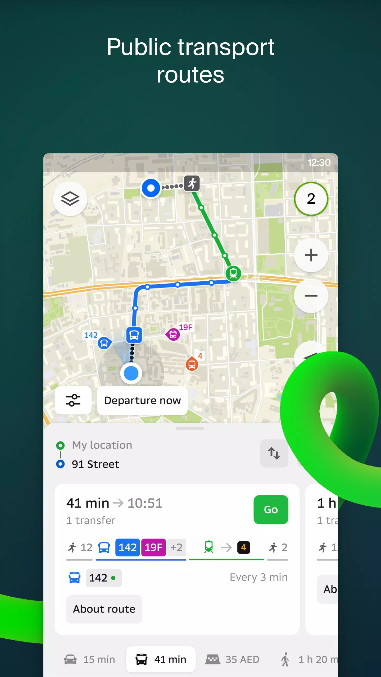
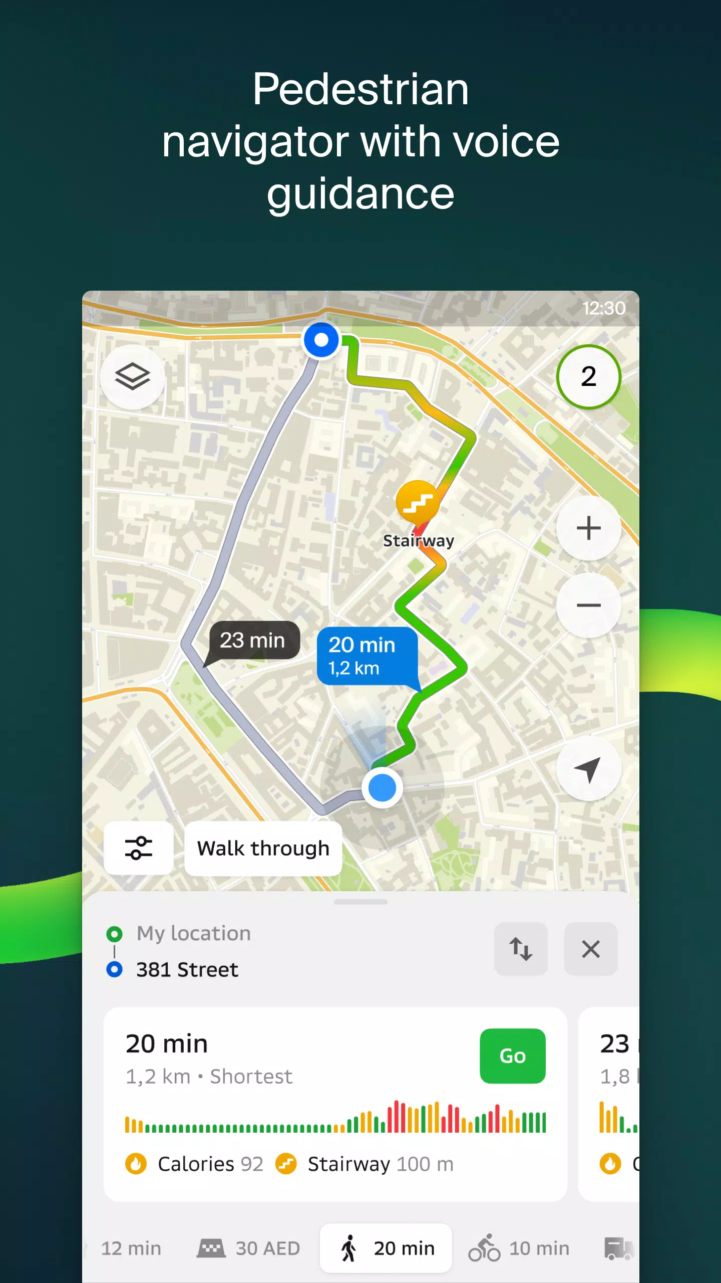
- Get detailed directions by car, bus, subway, or follow pedestrian navigation to your destination.
- Find building entrances and nearby parking lots effortlessly.
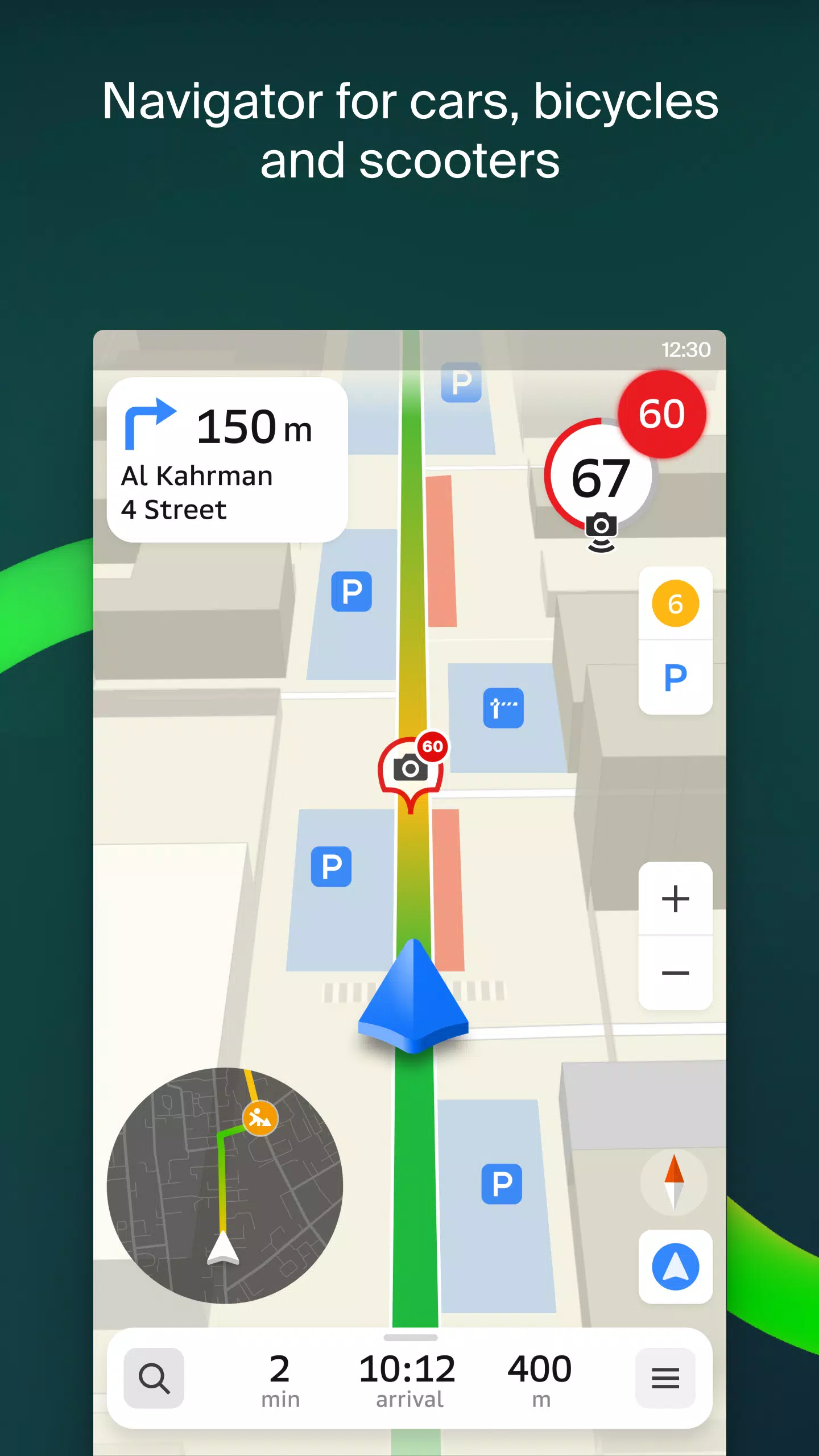
2GIS offers highly accurate maps that pinpoint districts, buildings, streets, bus stops, subway stations, gas stations, sports grounds, and more. The GPS navigation system takes into account real-time traffic conditions, road signs, speed cameras, toll roads, and unpaved routes, ensuring you reach your destination efficiently. It also supports route planning between cities and through multiple points, and there's a free app compatible with Android Auto.
Stay connected with loved ones using the live friends' location feature. Track your kids or friends on the map for added safety, send fun stickers, and monitor their battery levels. You control who can see your location and can adjust sharing settings at any time.
Stay informed about road events such as accidents, blocked streets, and speed cameras, all displayed directly on the map with user comments. 2GIS also provides detailed public transport schedules and online routes, making it easy to plan your journey.
For pedestrians, 2GIS offers walking routes with background navigation and voice guidance, ensuring you can navigate on foot with ease. Truck drivers benefit from specialized navigation that considers vehicle and cargo specifics.
The detailed directory in 2GIS includes addresses, entrances, postal codes, phone numbers, operating hours, social media links, websites, and user-generated photos and reviews of businesses. Additionally, the travel guide feature highlights main attractions and places with Wi-Fi, enhancing your exploration experience.
For smartwatch users, the 2GIS Notifications companion app on Wear OS 3.0 or later versions offers a seamless navigation experience. View maps, receive maneuver hints, and get vibration alerts when approaching turns or bus stops directly from your wrist.
2GIS covers a wide range of cities across multiple countries, including:
- Cities of the UAE: Dubai, Sharjah, Abu Dhabi, Al Ain, Ajam, Ras Al Khaimah, Fujairah, Umm Al Quwain, Dibba Al Fujairah, Khor Fakkan, Kalba, Al Salamh, and more.
- Cities of Russia: Moscow, Saint Petersburg, Novosibirsk, Ekaterinburg, Krasnoyarsk, Chelyabinsk, Ufa, Omsk, Kazan, Perm, Nizhny Novgorod, Sheregesh, and more.
- Cities of Belarus, Kazakhstan, Uzbekistan, Azerbaijan, and Kyrgyzstan: Minsk, Pavlodar, Semey, Aktau, Aktobe, Almaty, Nur-Sultan, Bishkek, Karaganda, Kokshetau, Kostanay, Osh, Baku, Tashkent, and more.
For any support, you can reach out to [email protected].