Looking for a streamlined way to handle your KML/KMZ/GPX files? Need GIS capabilities, measuring tools, GPS logging, WMS support, and offline maps? Look no further than Mapinr. We understand the rapid evolution of Android versions poses challenges for non-profit projects like ours. However, we are committed to keeping Mapinr alive, ensuring it remains secure, privacy-focused, and affordable for all users.
We're aware that Google's requirements might exclude some devices from running the latest version of our app. That's why we offer downloads for older Android versions (below Android 14), which are no longer supported by the Play Store, directly on our website.
Whether you're looking to manage your personal points of interest or want to create photomaps from your pictures, MAPinr is your go-to solution. Our simple, ad-free Android app is designed for both professional use and outdoor enthusiasts engaged in activities like hiking, cycling, running, and skiing.
We value your feedback and welcome your suggestions for improving MAPinr. Please share your thoughts and ideas with us at [email protected]. We understand the frustration that comes with software bugs, and we appreciate your patience as we work with limited resources to enhance the app.
MAPinr offers a comprehensive set of features to meet your needs:
- Ad-Free Experience: Enjoy a clutter-free environment with no ads.
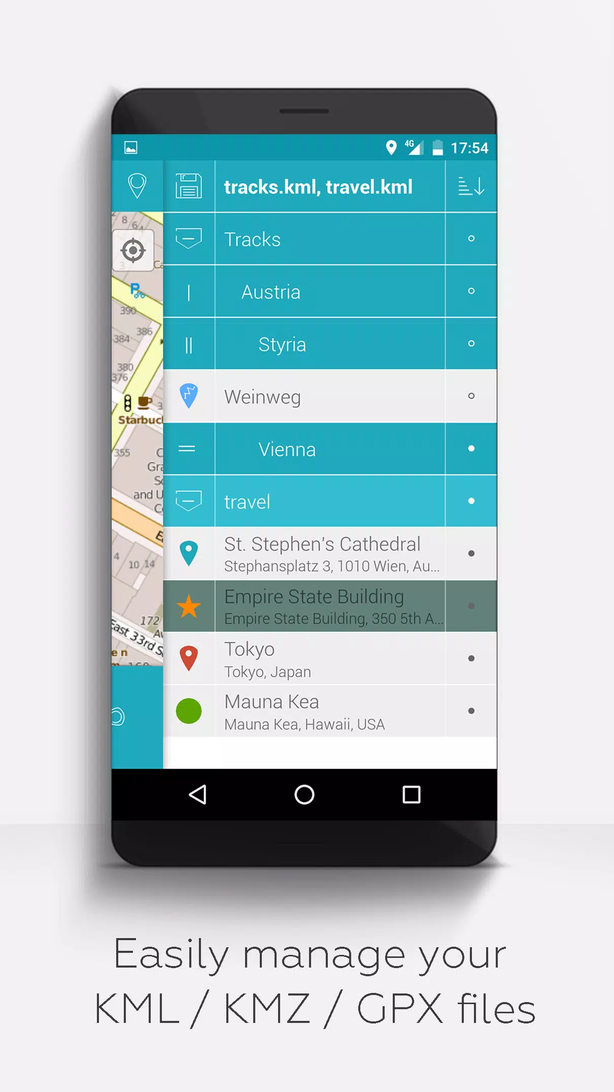
- Organized File Management: Use a hierarchical folder structure to manage multiple KML/KMZ/GPX files effortlessly.
- Full KML/KMZ Support: Create, load, edit, save, import, export, and share KML/KMZ files with ease.
- Comprehensive Waypoint Management: Create, load, edit, save, import, export, and share waypoints, lines/tracks, and polygons.
- Photomap Creation: Add pictures to your waypoints to create personalized photomaps.
- Versatile Map Display: Display waypoints, lines/tracks, and polygons on various maps including Maps, Satellite, Hybrid, OpenStreetMap, Opentopomap, and Opencyclemap.
- Coordinate Sharing: Share the coordinates of your waypoints with others.
- Customizable Colors: Individually colorize your waypoints, lines/tracks, and polygons for better visibility and organization.
- Interoperability: Open exported KML/KMZ files in other apps seamlessly.
- Advanced Search: Search by name, address, and coordinates for quick access to your data.
- Location Sharing: Share your location with friends to keep them updated on your whereabouts.
- Multi-File Support: Display multiple KML/KMZ/GPX files simultaneously for comprehensive analysis.
- File Merging: Merge KML/KMZ files to streamline your data management.
- Cloud Integration: Access and manage your files from the cloud for convenience and backup.
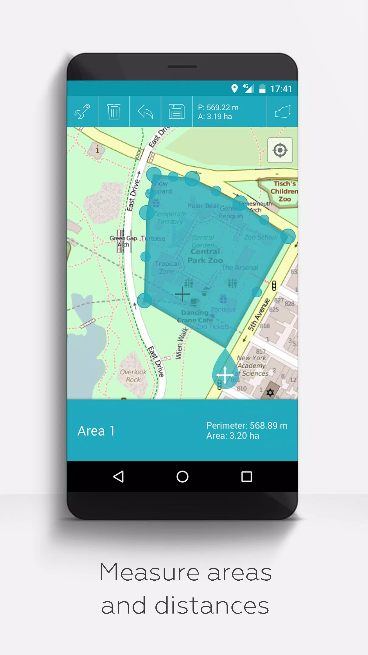
- Measurement Tools: Measure distances and areas directly on your map for accurate planning and analysis.
- Multilingual Support: Currently available in English, Spanish, Lithuanian, and Polish, with more languages to come.
For those who wish to unlock extended features, consider making a donation or showing your support on LinkedIn. Once activated in the settings, you can enjoy:
- Offline Maps: Download maps for free from OpenStreetMap to use offline.
- GPX Viewer: View GPX files without limitations.
- Web Map Service (WMS): Display arbitrary map data from services like www.data.gov.
- Custom Metadata: Create and manage custom metadata for your files.
- Custom Icons: Upload and use your own icons for personalized mapping.
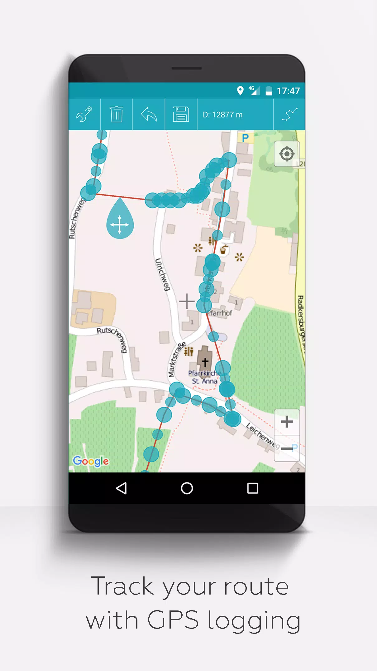
- GPS Track Recording: Record your GPS tracks for later analysis and sharing.
Unlike other apps, MAPinr respects your privacy and does not collect or sell your personal data. Your donations are a voluntary contribution to support our non-profit mission. Join us in making MAPinr the best it can be!